From Shobdon to Aberystwyth and back
A flight in G-ATON, by Greg Scott
West from Shobdon
Flying west from Shobdon means taking account of the high ground in Mid Wales, where the terrain reaches roughly 2,500 feet above mean sea level in places. The British cloud base is not always accommodating, and several things need to align for a flight under visual flight rules (VFR). Cloud base has a large say in the plan.
On this particular day, though, there was not a cloud in sight and the winds were light. The plan was to fly west to Aberystwyth, enjoy the coast from the air and return to Shobdon. After the usual refuelling, I set about the navigation planning with two digital devices, a laminated air chart and a pen. That should cover the navigation.
Fortunately, runway 26 was in use. With the normal checks complete, I lined up on the hard runway. Call me old-fashioned, but an engine failure on take-off, or shortly afterwards, is always uppermost in my mind. Full throttle, then airborne and into the climb. Heading west, height was what I wanted.
That day, I gained it with a lazy S outside Shobdon’s zone before continuing west. The distant high ground played its optical trick, making it look as though I still needed more height. After several minutes, with SkyDemon’s purple lines showing the way, I was over the hills.
Across Mid Wales to the coast
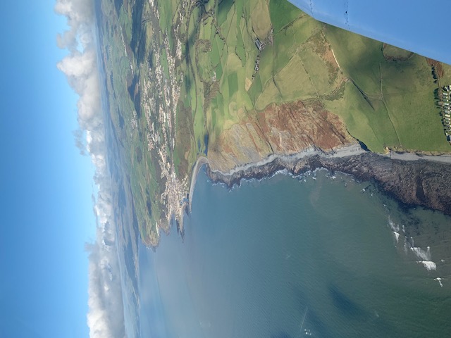
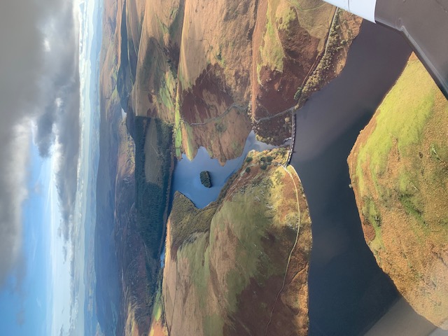
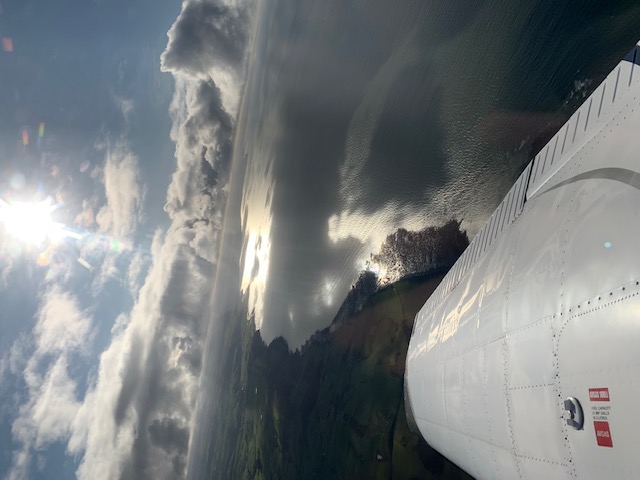
From aloft, the landscape can look rather featureless and benign. A fellow pilot who made an emergency landing in this part of the world would attest that it is nothing of the sort. The photographs below give a flavour of the country beneath us.
Wind farms appeared from time to time, standing like sentinels across the landscape. From 5,000 feet they looked small. There seemed to be very little in the middle of Wales: a few settlements and scattered farms, then long stretches of open country. More striking were the blue-grey reservoirs, their glassy surfaces enclosed by steep hillsides. They really drew the eye.
At 5,000 feet, with no cloud and no inversion, visibility was good. The Irish Sea was visible from a long way off, looking rather plain and grey beside the landscape. Aberystwyth itself remained hidden behind the inland high ground. I passed the first waypoint, Llanidloes, and there was still no sign of the town.
Eventually, almost at the last moment, Aberystwyth appeared. I made a few orbits overhead, looking up and down the coast. The mountains of North Wales were easy to pick out in the distance. It was a chance to enjoy the view before turning for home.
Home via the Elan Valley
The return took me along a more southerly route, past the reservoirs of the Elan Valley and more wind farms. The scenery had not changed greatly, but there was still plenty to look at.
Time to tune back in to Shobdon. I prefer to listen and build a picture of the traffic before arriving, rather than simply turning up and announcing that I am there. Circuit traffic sounded normal, and the flight ended with an uneventful landing back on runway 26.